If the weather becomes stormy for a short time and then becomes colder, which type of front has most likely passed?
1 Answer
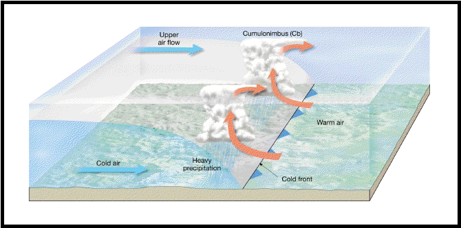
Cold front.
Explanation:
A cold front has a much higher slope than a warm front. I can remember a rough rule of thumb being a ratio of 70:1.
https://aesnotes.wordpress.com/2013/07/08/fronts/
Normally the bases of Cumulonimbus clouds are not above 5000 ft as such thunderstorms will normally be from just ahead of the surface position of the front to about 70 miles behind the it. (The reason it can be ahead of the front is the outflow winds from thunderstorms can blow ahead of the front and these winds can cause the uplift needed to generate thunderstorms)
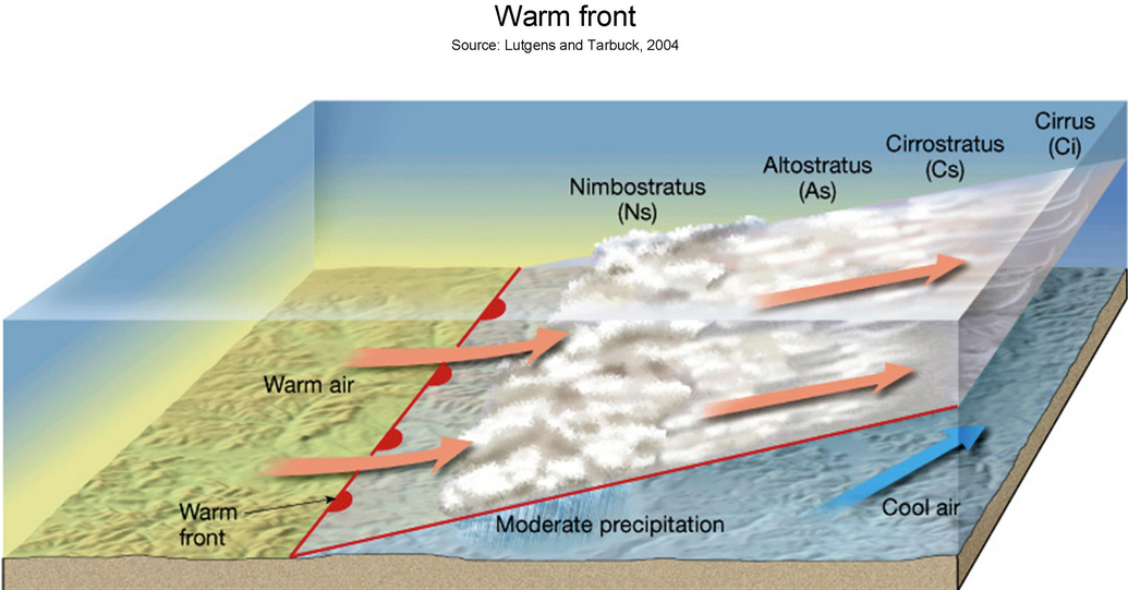
Conversely a warm front as a much more gentle slope. (around 200:1)
https://aesnotes.wordpress.com/2013/07/08/fronts/
You can see from the diagram that you are getting precipitation from a considerable distance ahead of the front (say 120 miles). The diagram doesn`t show it but you can get precipitation behind the warm front for a short distance because all the precipitation ahead of the front will increase the humidity of the air. So you start with high humidity and once the front passes the increase in heat will evaporate the water on the ground (from all that precipitation). This will cause low cloud and fog (potentially) and precipitation for a few miles behind the front.
As you can see from the diagrams cold front generally cause thunderstorm activity, and warm fronts generally cause long periods of rain (I have seen nimbostratus cloud produce precipitation for over 20 straight hours).
