What is the first sign of an approaching warm front?
1 Answer
Cirrus clouds.
Explanation:
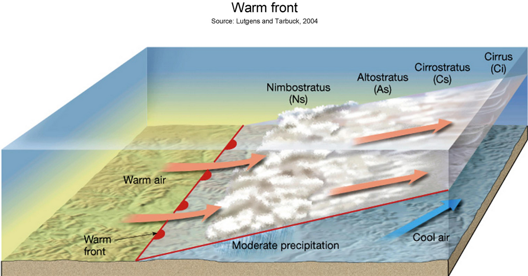
The angle of a warm front is around 200 miles for every one mile upward. That means the part of the front that is aloft is going to go over you long before the surface front does.
https://rgsweather.com/tag/warm-front/
Here you can see that first you get cirrus clouds that become thicker, eventually giving way to altostratus and finally Nimbostratus clouds. Precipitation begins with Altostratus clouds and becomes heavier with the Nimbostratus.
The wind direction is going to change but that really only happens when the surface front passes. Generally the wind before the passage is going to be from the east, although whether north east, east or south east is going to depend on how the front is lying. After front passage the wind will veer, or turn in a clockwise direction.
Air pressure will drop as the front approaches and will be at the lowest during frontal passage, at which point the air pressure will rise again.
