How do scientists use seismic waves to map the earth's interior?
1 Answer
This isn't simple, but I'll give a beginners guide...
Explanation:
Waves transfer energy from source to detector. They also tend to reflect at sudden changes in density. Waves that travel outwards (in 3D) from the epicentre of an earthquake (or more precisely the focus, as the epicentre is the point on the *surface * where waves first appear) can be reflected when they hit the interface between crust and mantle as they travel downwards, so return towards the surface and are detected there.
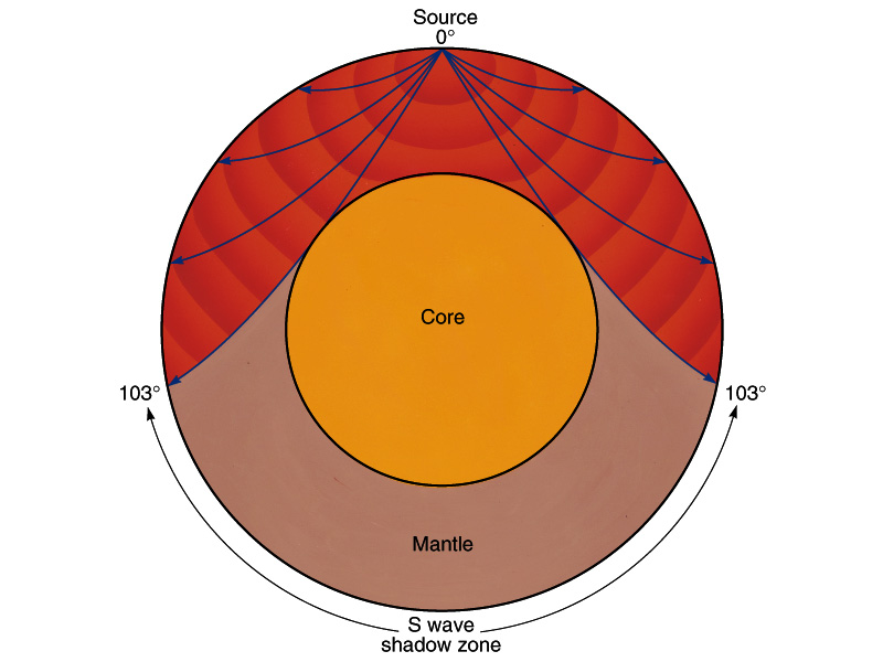
Longitudinal waves (primary, or p-waves) are able to travel through both liquids and solids, so can move down through both crust and mantle and through the outer core. The transverse or secondary (s-waves) are not able to do so. This means that on the opposite side of the earth to the focus, there will be a region of the earth where no s-waves are detected, the size of the "s-wave shadow" gives the size of the outer, liquid, core.
The inner core is again solid, but the sudden change in density causes some p-wave reflection towards the surface again, meaning its size can be estimated.
Hope that helps ... it is only the primer for geophysics - sorry!
The diagram here may help:


