Why are topographic maps are important?
1 Answer

If you are using them for navigation, they can show you where easier paths might be.
Explanation:
There are so many wonderful things about what topographic maps show us!
-
They show us man-made features that we can use to find our way. Man-made features are drawn in black. Roads, railways, power lines - they can be used as "handrails", which are things that can guide you or give you a boundary to your adventure. Trails (shown as dashed black lines) can also provide a more easily navigated path to follow.
-
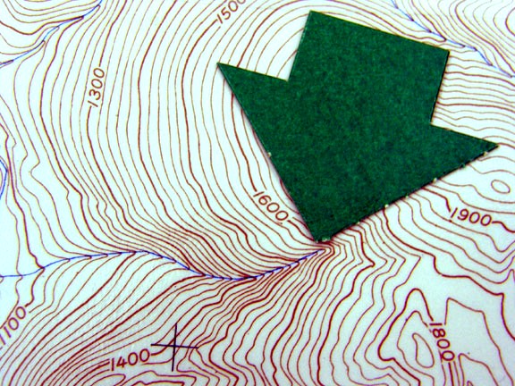
They show us natural water features that we can use to find our way. Water features are in blue. Direction of stream travel can be determined by how the stream encounters the contour lines; the contour lines point upstream. In the example below, the stream runs from east (right) to west (left). The green arrow points at the head of the stream.
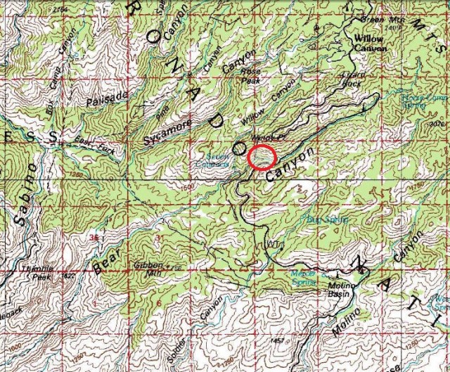
- They show us heavy vegetation, as areas shaded in green. This map shows an area of Coronado National Forest.
- They show us, by looking at the contour lines, where the gradual slopes are and where the steep slopes and cliffs are. The contour lines that are far apart are gradual slopes; the contour lines that are close together are steep. If you are navigating, it is easier to walk on the shallower slope. Other features such as saddles (the place between two peaks) are generally also easier to navigate.
